By Jameson
Kenya is likely to experience a mixed March to May 2026 long rains season, with wetter conditions in the highlands and the Lake Victoria Basin but depressed rainfall along the Coast and in parts of the arid north and southeast, according to the latest national climate outlook from the Kenya Meteorological Department.
A technical statement from the Twelfth National Climate Outlook Forum projects near average to above average rainfall over the Lake Victoria Basin, the Highlands West and East of the Rift Valley including Nairobi, the Rift Valley and parts of northwestern Kenya.
Acting Director of the Kenya Meteorological Department Edward Muriuki said the season will still be marked by variability despite the favorable outlook in several regions.
“This season is expected to have a normal to late onset over most parts of the country and will likely be characterized by intermittent dry spells, even in areas projected to receive near average to above average rainfall,” said Muriuki.
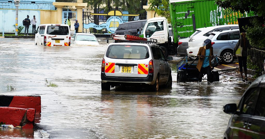
He added that occasional heavy rainfall events are likely in several parts of the country, raising the possibility of localized flooding.
Near average to below average rainfall is expected over the southeastern lowlands and northeastern counties, while the Coast is forecast to receive below average rainfall overall. Despite the depressed outlook in coastal areas, the department warns that isolated heavy storms may still occur.
“The outlook shows that several areas are likely to experience generally poor to fair temporal and spatial distribution of rainfall. This means communities should prepare for uneven rainfall patterns within the season,” Muriuki said.
April is expected to mark the peak of the rains in most parts of the country, except for the Coast, where the peak is projected in May.
The department also forecasts warmer than average temperatures across the country, with higher probabilities over the Lake Victoria Basin, the Coast, the southeastern lowlands and parts of northeastern Kenya.
Meteorologists say the seasonal outlook is based on global climate model guidance and statistical comparisons with previous years that had similar large scale climate signals, particularly 2023. However, intraseasonal systems such as tropical cyclones and the Madden Julian Oscillation could still influence rainfall at shorter time scales.
Muriuki urged government agencies, farmers and disaster preparedness teams to rely on regular updates throughout the season.
“This outlook should be used together with our 24 hour, 5 day, 7 day and monthly forecasts, as well as county level advisories. We will continue providing regular updates to support timely decision making across climate sensitive sectors,” he said.
The Agency said it will issue weekly and monthly briefings on rainfall onset, distribution and cessation to help guide planning in agriculture, water resource management and emergency response during the long rains period.